
North Tonawanda ZIP Code Coverage
Only one ZIP is directly verified in the official city and parcel sources inspected for North Tonawanda. The record is deliberately narrow. It does not supply a complete postal-route table, a PO-box list, or proof that every address carrying the same postal label is inside city limits. Use an address-by-address USPS check for edge cases instead of adding an unverified ZIP to a directory search.
| ZIP | Areas Covered | Post Office | Notes |
|---|---|---|---|
| 14120 | North Tonawanda city addresses confirmed in city and inspected parcel sources | North Tonawanda mailing city; facility and route are address-specific | Only ZIP directly verified here; test edge and PO-box cases with USPS |
City Hall and the inspected North Tonawanda parcel addresses use 14120. That makes it a sound starting point for a specific address. It does not authorize a claim that 14120 is the whole municipal footprint or that another delivery arrangement does not exist. No official public text table was found that enumerates every postal route, PO box, or border assignment serving the city.
What North Tonawanda 14120 Does Not Prove
A ZIP is postal geography. North Tonawanda’s city limits, Niagara County parcel jurisdiction, USPS mailing-city label, delivery area, ward, election district, and historical Tonawandas coverage are separate systems. The city’s 2025 plan describes three wards across 10.85 square miles, but the plan wards are not ZIP boundaries. County GIS layers and an address result can sit near a border while the mailing label and municipal jurisdiction point in different directions.
The regional name adds another risk. North Tonawanda is in Niagara County, while the City and Town of Tonawanda are in Erie County. Confirm the county, city department, SBL or SWIS, court, and precise street before assigning a record to North Tonawanda. A postal result is valuable for delivery verification, but it cannot resolve every municipal or historical identity question by itself.
Note: Keep postal city, municipality, county, parcel identifier, ward, and record date as separate fields in research notes.
Verify North Tonawanda ZIP Codes With USPS
The USPS address lookup supports Find by Address and Find by ZIP modes. Enter a full street address with city and state when checking an edge address. The postal response can confirm the delivery ZIP and mailing-city result for that address. It is not a municipal-boundary map, and the inspected dynamic page did not expose a complete public table for local route or PO-box coverage.
The USPS lookup page is the official place to test a particular North Tonawanda address or an existing ZIP value.
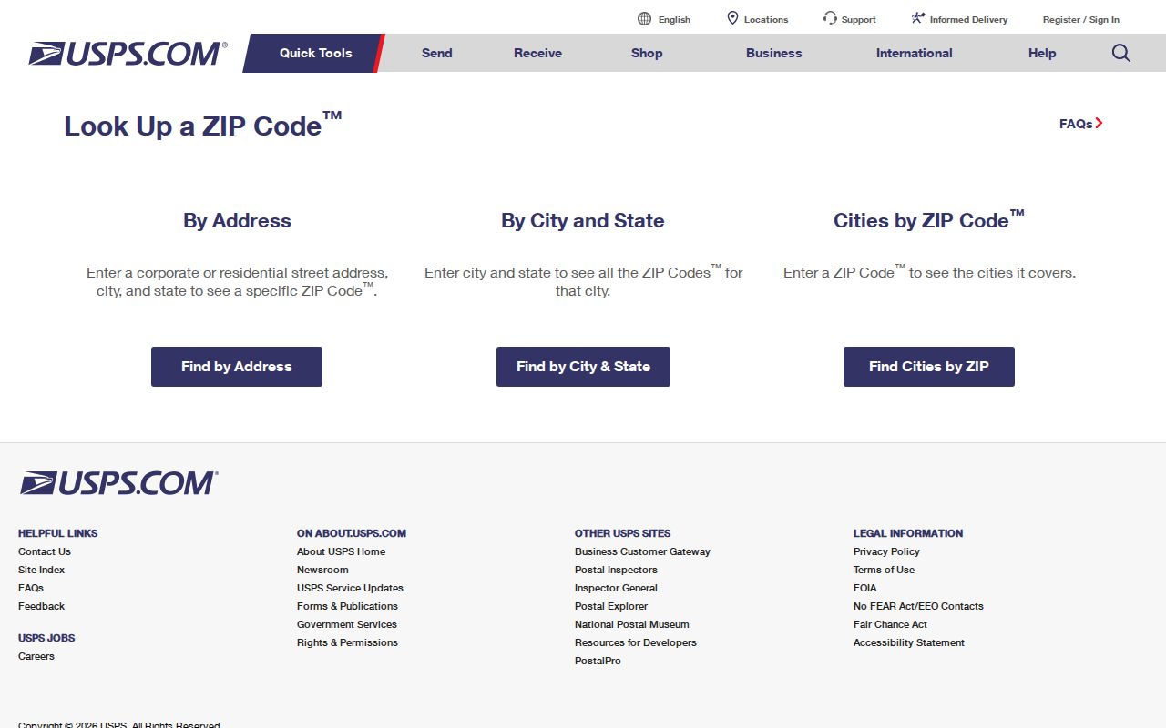
The USPS form is useful at the address level. Save the query date and the returned postal result, then make a separate city or county check if jurisdiction matters.
Search One North Tonawanda ZIP
A one-ZIP search should stay tied to a defined record set. No inspected official portal supports a ZIP-wide people lookup. USPS verifies individual delivery geography, the Board of Elections polling tool is address based, and a city or county FOIL request does not require an agency to create a new list. Begin by deciding whether the target is a postal delivery point, a city parcel, a tax parcel, a voter district, or a business mailing address. Those are not interchangeable groups.
- Write down the complete street address, postal city, state, and the ZIP already associated with the question.
- Run the full address through USPS and retain the delivery result and date.
- Check the municipality and street in ProsGAR, then save the SBL and SWIS if a matching parcel appears.
- Use the Niagara County GIS viewer to confirm parcel context and the municipal boundary when the address is near an edge.
- For a missing official record, ask the proper custodian for an existing, sufficiently described record set rather than a newly created ZIP list.
Once an address is verified, the North Tonawanda street directory is the narrower route for address-keyed research. It is better suited to a street and parcel question than a broad postal-code assumption.
North Tonawanda ProsGAR ZIP Limits
Niagara County ProsGAR advanced search offers property filters that can help investigate a confirmed address, including municipality, neighborhood, street, owner, property class, and assessment or physical characteristics. It does not expose a ZIP field. That limitation matters: a user cannot turn 14120 into a complete parcel or people search by entering it into this form. Use municipality, street, owner, or SBL for the record relationship that ProsGAR actually supports.
| Field | Type | Required | Notes |
|---|---|---|---|
| Municipality / Neighborhood / Street Name | Dropdown | No | Dynamic county options; use the municipality and street to narrow a parcel query. |
| Owner Name | Text | No | Owner name search, not an occupancy field. |
| Sale Date | Date text | No | Minimum and maximum date fields. |
| Property Class / House Style / Condition | Dropdown | No | Options were dynamic in the inspected form. |
| Account Number | Text | No | County account identifier. |
| Square Feet, Year Built, Sale Price | Minimum and maximum text pairs | No | Numeric property filters. |
| ZIP field | Not offered | Not applicable | No ZIP search field was exposed in quick or advanced search. |
The ProsGAR advanced-search form displays the property-focused filters that can substitute for a direct ZIP field when a municipality, street, owner, or account is already known.
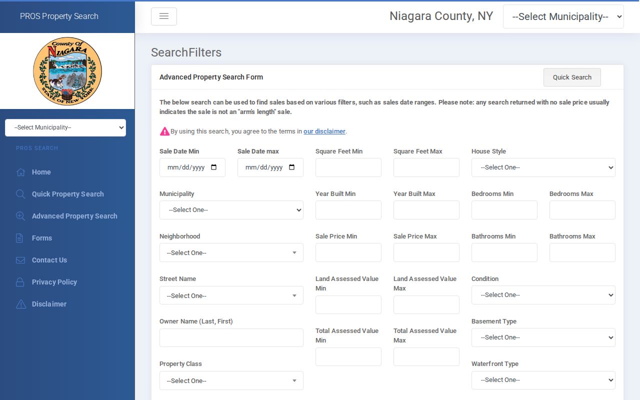
The form supports a parcel-oriented search. Its lack of a ZIP control is why a postal code must be verified separately rather than presented as a complete property or resident filter.
North Tonawanda ZIP Terms
Postal terms help describe a delivery result, but they do not replace city, county, or parcel terms. Use the exact field that a source displays. A PO box is a mailing location, for example, and should not be converted into a physical address.
- ZIP
- A five-digit USPS delivery-routing code associated with a mailing result, not a municipal boundary.
- ZIP+4
- The extra four digits that refine delivery routing for an address or delivery point within a five-digit ZIP.
- PO-box ZIP
- A postal code used for a post-office box arrangement. It does not establish the box holder’s physical location.
- Carrier route
- A USPS delivery grouping used for mail handling. It is not a city ward, parcel block, or resident roster.
Note: A postal result should be copied with its full address context, since ZIP-only notes lose the boundary information needed for later checks.
North Tonawanda Wards and Postal Lines
North Tonawanda’s three planning wards are useful for organizing local geography, not for creating a ZIP map. The 2025 comprehensive plan describes Ward 2 as downtown with denser residential fabric and identifies Wurlitzer Park, Martinsville, waterfront, transportation, industrial, wetland, and Deerwood Golf Course context across the city. Those labels can help a researcher choose a map or agency. They do not identify the ZIP for a particular address.
Near the Niagara River, Erie Canal or Tonawanda Creek, the Wheatfield edge, and Tonawanda-region streets, compare the exact address against the county parcel viewer and the appropriate city or county jurisdiction. This geography check is more reliable than assuming a postal label settles a line on the ground.
North Tonawanda ZIP Record Boundaries
The Board of Elections polling-place tool is an address lookup, not a public resident-name directory. Voter-record access and requests have their own Election Law and FOIL limits, including an elections-purpose statement and protected confidential registrations. Property records likewise identify an owner or mailing address, not every person at a location. Keep the role in the source: postal delivery result, parcel owner, tax mailing recipient, voter record, or directory-listed person.
When the needed result is not online, the useful fallback is a specific request for an existing public record held by the relevant office. A broad request for everyone in a ZIP can confuse incompatible geographic systems and may not correspond to a record the agency keeps.
North Tonawanda Postal History
Postal codes postdate many city directories, censuses, deeds, and newspaper notices. Do not append 14120 to an 1893 North Tonawanda address as if that was the historical mailing format. Preserve the original street and municipality wording, then make any modern ZIP crosswalk in a separate field with the source and date that support it.
For an old street number, a legal description, subdivision map, SBL, and dated directory or census record can be stronger than a modern postal shorthand. That distinction keeps historical research useful without creating false precision about a former address.